To read more content about AviNews-América Latina Sep 2015
To read more content about AviNews-América Latina Sep 2015
Contenido disponible en:
Español (Spanish)
The satellite location systems – Geographic Information Systems, GIS – for poultry farms, consist of computer packages – software – that allow the visualization and analysis of geographic information through remote sensing.
Apart from localizing with precision any geographic coordinate, these systems allow for the addition to geographic map images of several layers with a great variety of geographic data – such as images detecting variables at a distance, minor roads, highways or freeways, geology, hydrology, natural or geopolitical boundaries between cities, counties, departments, regions, etc.
This data may be voluntarily superimposed so that maps may be illustrated generating useful data for different types of industries and with great precision as regards distances.
EXACT LOCALIZATION OF FARMS
For example, all poultry farms or facilities of any geographical area may be represented in the maps within one of the many “layers” which may be illustrated on each map.
The resulting maps allow for the analysis in time and space in relation to prevalence of disease
Any type of information of interest may be added to each map, such as, for example, distance between farms, distance between farms and highways or processing plants, natural barriers, etc.
TOOL FOR THE EXPERT
The resulting maps may be very useful for the expert in poultry health:
The assessment of this data allows for the analysis in time and space in relation to prevalence of disease.
OFFICIAL CONTROL TOOL
They are also very useful for official notice and official compartmentalization of diseases in order to continue with international trade practices of birds and poultry products under certain circumstances.

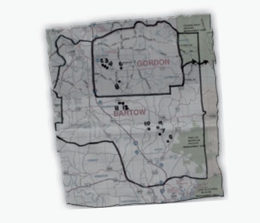
Figure 1. Old map which shows the approximate location of a geographical area
affected by certain respiratory disease.
Localization of farms in the epidemiological area and farms contained in said area
was made by drawing them by hand.
Before the development of